Updated: July 22, 2026
From leisurely family rides to triathlon training, Columbus is full of epic bike trails.
Columbus has always had a hardcore group of cyclists, but lately, riders have been increasing. Between cycling to work to save the environment and training for the annual Columbus Pelotonia, biking has become somewhat of a trend in our city.
With Rapid 5 working to connect the region’s five waterways and the Capital Line, a two-mile bike and pedestrian loop that broke ground downtown in late 2025, the city keeps finding new ways to get people out of their cars and onto a path.
Bike trails new and old are spread out all around the town and beyond to help you get back on your bike. Check out nine of the best trails and greenways around Central Ohio.
Columbus Bike Trails At A Glance
| Trail | Miles | Surface | Route |
| Alum Creek Trail | 24.5 | Paved | Westerville to Three Creeks Park |
| Blacklick Creek Trail | 16 | Paved | Reynoldsburg to Three Creeks Park |
| Olentangy Trail | 14 | Paved | Worthington to downtown Columbus |
| Camp Chase Trail | 12.5 | Paved | Madison County line to the Scioto Trail |
| Darby Creek Greenway | 8.5 | Gravel | Battelle Darby and Prairie Oaks (two sections) |
| Big Walnut Trail | 7.7 | Paved | Hoover Reservoir to Inniswood (in sections) |
| Heritage Trail | 6.1 | Paved | Old Hilliard to Plain City |
| Scioto Trail | 5.6 | Paved | Berliner Park to Dodge Park |
| Genoa Trail | 4 | Paved | Westerville to Galena |
Alum Creek Trail
Distance: 24.5 miles
This path runs from Westerville down to Three Creeks Metro Park near Groveport, passing Easton and Bexley along the way, and stretches of it double as the Ohio to Erie Trail’s route through the city. It runs along, or rather over, Alum Creek with plenty of bridges to cross making for great spots to stop and take photos. The Alum Creek trail also connects to the Blacklick Creek Greenway trail at Three Creeks Metro Park.

Blacklick Creek Greenway Trail
Distance: 16 miles
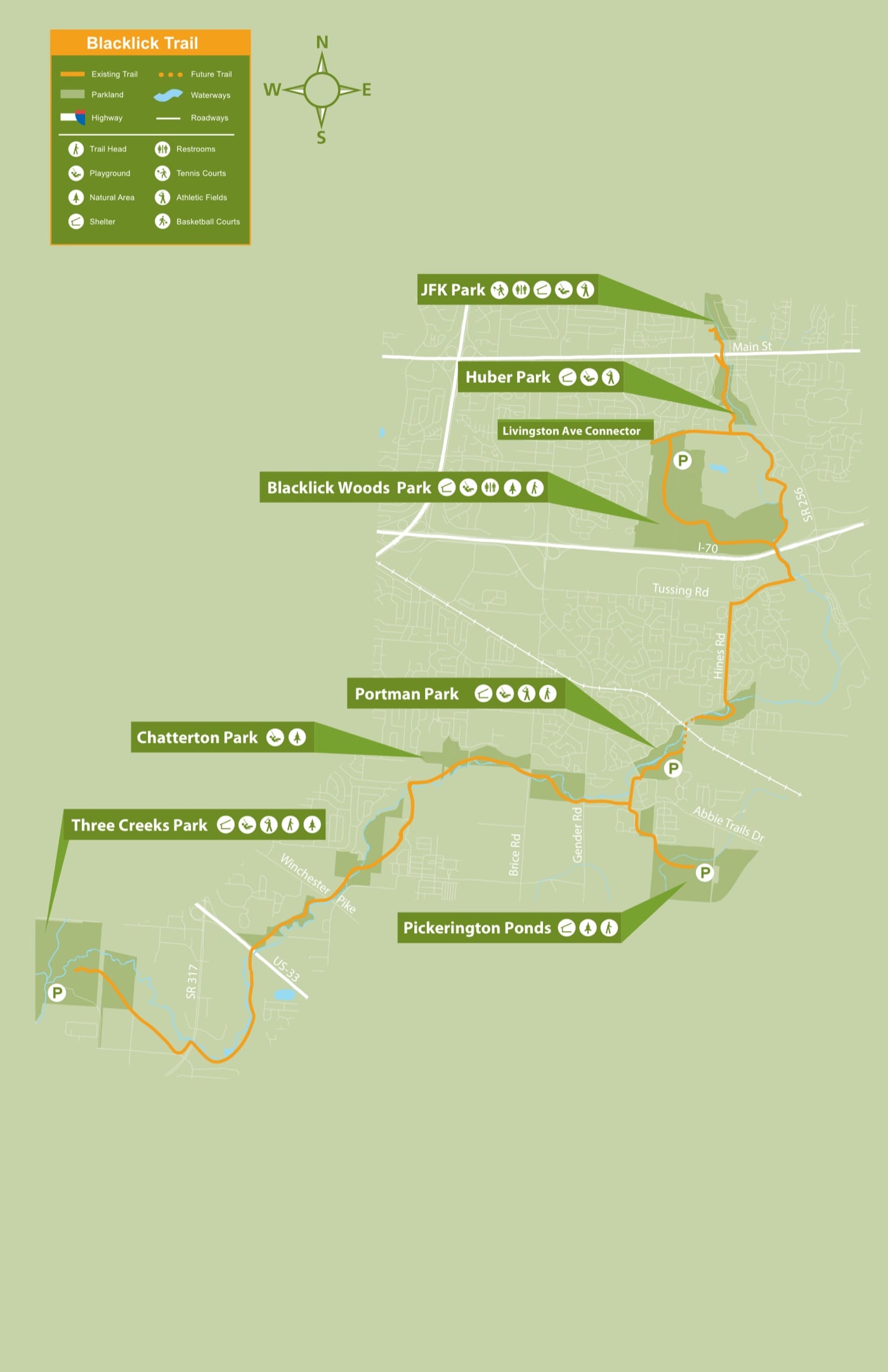
This trail runs parallel to Blacklick Creek for most of the ride. Passing through multiple parks this is a great trail to make stops if you want to pack a snack, or just like to rest in the grass for a minute. The trail goes from Reynoldsburg, through Blacklick Woods Metro Park, down to Three Creeks Metro Park near Groveport.
Big Walnut Trail
Distance: 7.7 miles (in separate sections)
Know before you go: this one’s still a work in progress, and the sections don’t all connect yet. The longest finished stretch runs from Hoover Reservoir down to Inniswood Metro Gardens, and the Gahanna piece drops you right at Creekside, a great place to stop for a bite or just watch the water. The long-term plan links everything from Hoover down to Three Creeks Metro Park, but the southern connection isn’t slated for construction until 2028.
Scioto Trail
Distance: 5.6 miles
This is the downtown showpiece. It runs from Berliner Park just south of German Village up through the Scioto Mile, where you’ll get the best skyline view in the city, then ties into the Olentangy Trail at the north edge of downtown. Along the way you’ll pass Scioto Audubon Metro Park, a great place to relax or get an extra workout in at the free outdoor climbing wall. You’ll need your own gear though.

Camp Chase Trail

Distance: 12.5 miles
This rail trail runs from the Madison County line to the west side of Columbus, where the Hilltop Connector ties it into the Scioto Trail if you want to ride downtown. It’s also the city’s leg of the Ohio to Erie Trail, so the pavement keeps going: Roberts Pass picks up toward London and the Prairie Grass Trail carries you on to South Charleston and beyond. The path runs through Battelle Darby Creek Metro Park on the way out of town.

Olentangy Trail

Distance: 14 miles
From downtown Columbus up to Worthington, this trail takes you along the scenic Olentangy River. It’s finally whole: the last gap, between Northmoor Park and Clinton-Como Park in Clintonville, opened in November 2025, so you can ride all 14 miles without detouring onto neighborhood streets. One heads up: the city plans to resurface a few sections in summer 2026, closing one short stretch at a time for a week or so each.
Darby Creek Greenway

Distance: 8.5 miles (two separate sections)
This one has two separate sections in two different parks: about 5 miles through Battelle Darby Creek Metro Park and another 3.5 through Prairie Oaks. They don’t connect to each other, and unlike everything else on this list, the surface is crushed gravel, so it suits a hybrid or mountain bike better than skinny road tires. The Battelle Darby stretch cuts right past the park’s bison pastures, so keep an eye out for the herd.
You can view the Darby Creek Greenway map here.
Genoa Township Trail

Distance: Four miles
This trail runs from Westerville to just south of Galena at the Hoover Reservoir. At the Galena end it meets the Hoover Scenic Trail, worth a slow lap for the reservoir views alone. The tree cover makes this one of the prettiest short rides around, especially once the leaves turn. Click here to see a map of the trail.
Heritage Trail
Distance: 6.1 miles
This rail trail runs from Old Hilliard out to Plain City, past Homestead Metro Park, and it’s the flattest, easiest ride on the list. Old Hilliard’s patios sit right off the trailhead, so it’s an easy one to pair with lunch or a post-ride beer. It’s where I’d send a first-timer.
Columbus Bike Trail FAQ
What’s the longest bike trail in Columbus?
The Alum Creek Trail is the longest single greenway in the city at 24.5 miles, running from Westerville to Three Creeks Metro Park. Want more? It connects straight into the Blacklick Creek Trail for another 16.
Are Columbus bike trails paved?
Every trail on this list is paved except the Darby Creek Greenway, which is crushed gravel.
Is the Olentangy Trail finished?
Yes. The final gap between Northmoor Park and Clinton-Como Park opened in November 2025, so it now runs 14 miles without interruption. Expect short rolling resurfacing closures in summer 2026.
Can you bike from Columbus to Cleveland or Cincinnati?
You can. The Ohio to Erie Trail crosses Columbus on the Camp Chase and Alum Creek trails as part of its 326-mile route between Cincinnati and Cleveland.
Where do the trails connect?
Three Creeks Metro Park is the big junction, where the Alum Creek and Blacklick Creek trails meet. The Scioto and Olentangy trails link up at the north edge of downtown, and the Hilltop Connector ties the Camp Chase Trail to the Scioto Trail.